

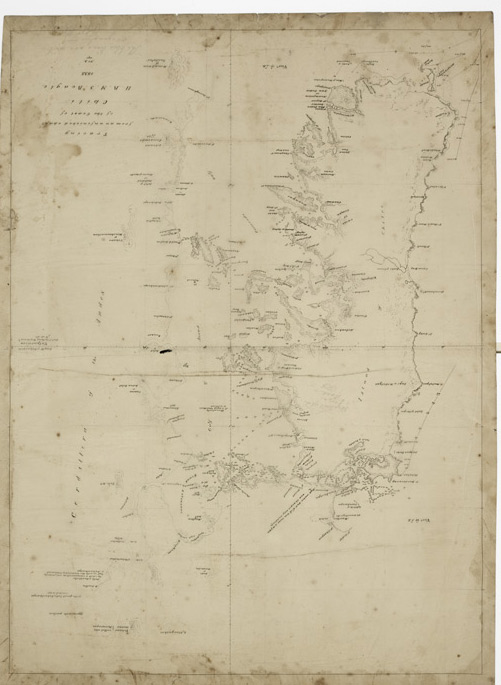
The island of Chiloé
 |
|---|
| Captain FitzRoy's chart of the island of Chiloé |
In 1834, whilst surveying the southwestern coast, the Beagle twice docked at the island of Chiloé. While the Beagle herself surveyed the more exposed coasts, her boats worked in shallower waters and more confined spaces. FitzRoy gave his sister an account of what nearly became an international incident. It had emerged from the Beagle’s survey that in the earlier Spanish-made charts, the island appeared rather longer than it should. One of the Beagle crew remarked to a local inhabitant that in their new survey, they had ‘cut-off twenty-five miles’ of the island. Unfortunately this was understood to mean that the English had taken possession of a large area whereupon the islanders rose up in arms to support the English against the Spanish in what they took to be an attack on the Chilean mainland.