 |
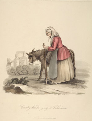
| A woman on her way to sell potatoes in Valenciennes,
from Miss Semple’s The costume of the Netherlands…
after drawings from nature (London, 1817) [original document
not on display] |
Travel & Topography
Over centuries, the collections of great libraries have reflected
the fascination for the curious reader of distant lands and uncharted
seas. Conscious of this long-standing tradition, the Friends of
Cambridge University Library have made great efforts to purchase
works that assist the reader either to travel, literally or in the
mind, through foreign lands, or to speculate, sometimes very imaginatively,
on the marvels to be found in remote parts of the world. During
recent years, the Friends have made particular efforts to develop
the remarkably rich collections held in the Library’s Map
Room. Maps donated or purchased with the Friends’ help range
across time and space, elegantly portraying great landed estates,
charting volcanic eruptions in Italy, and displaying intricate stagecoach
and railway routes, the commercial, social and industrial arteries
of Georgian and Victorian Britain.
Items on display
Constantino von Wahrenberg [Philipp Balthasar Sinold von Schütz]
(1657-1742), Die glückseeligste Insul auf der gantzen Welt,
oder das Land der Zufriedenheit, Leipzig, 1723 (7746.d.98);
Madagascar: or, Robert Drury’s journal during fifteen
years captivity on that island, London, 1729 (7000.d.216);
Picturesque views in Devonshire, Cornwall, &c., London,
1826 (Harley-Mason.b.133); The Intelligencer: or, Merchant’s
assistant, London, 1738 (7428.e.3); Kupfersammlung zu Göthe’s
sämmtlichen Werken, Sechste Lieferung, Leipzig, 1829 (8002.c.27);
Flora Tristan (1803-1844), Promenades dans Londres, Deuxième
édition, Paris and London, 1840 (F184.c.4.1); Anonymous
cartographer, ‘A platt, map, or geographicall description
of divers lands in the parish of Uggeshall in the Cownty of Suff’…’,
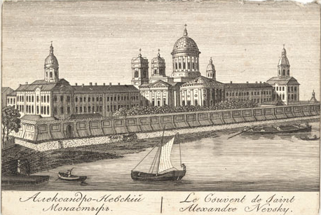
England, 1 January 1650 (MS Plans.904); Aleksandr Dmitrievich Savinkov
(1769-1835) and Gavriil Andreevich Sarychev (1763-1831), Plan
de la ville capitale de St Petersbourg (part), [St Petersburg],
1820 (Maps.c.18.H.90); Giuseppe Gemmellaro (1787-1866), Historical
& topographical map of the eruptions of Etna from the æra
of the Sicani to the present time, intended to show the origin,
the direction & the age of each eruption, London, 1828
(Maps.bb.18.H.60). View
exhibit captions.
|