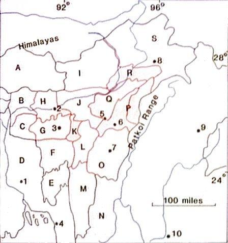
| caption: |
map of the Excluded Areas of Assam |
| text: |
based on Sir Robert Reid's map in 'The Excluded Areas of Assam', The Geographical Journal, Jan.-Feb. 1944 |
| text: |
Key. A = Bhutan B = Goalpara C = Garo Hills D = Tippera E = Tripura F = Sylhet G = Khasi States H = Kamrup I = Balipara Frontier Tract J = Darrang and Nowgong K = Khasi and Jaintia Hills L = Cachar M = Lushai Hills N = Chin Hills O = Manipur P = Naga Hills Q = Sibsagar R = Lakhimpur S = Sadiya Frontier Tract |
| text: |
1 = Dacca 2 = Gauhati 3 = Shillong 4 = Chittagong 5 = Dimapur 6 = Kohima 7 = Imphal 8 = Sadiya 9 = Myitkyina 10 = Mandalay |